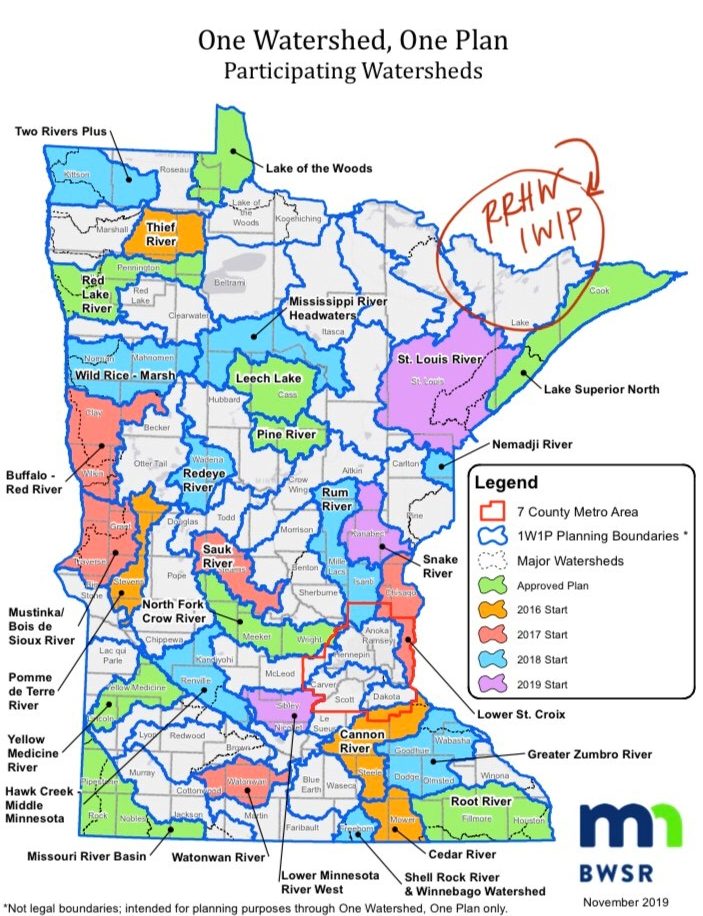
Rainy River Headwaters
One Watershed One Plan
Lake County and Lake SWCD are excited about a One Watershed, One Plan in the Rainy River Headwaters! Lake SWCD began exploring this planning process upon completion of the Lake Superior North 1W1P in 2017. The Rainy River Headwaters Portion of Lake County is a watershed which drains all the way to Hudson Bay, and is an area of Minnesota primed for protection. Comprehensive watershed-based funding guidelines suggest beginning a One Watershed, One Plan after completion of WRAPS (or Watershed Restoration and Protection Strategies) for a watershed. Intensive watershed monitoring for the RRHW began in 2016 and has since been completed. No significant watershed stressors have yet been identified in Lake County. Impairments in the watershed remain primarily Mercury (Hg) impairments for fish consumption. Here are RRHW WRAPS documents:
Rainy River Headwaters WRAPS 2022
Rainy River Headwaters TMDL 2022
Rainy River Headwaters WRAPS Summary
Full details on the Rainy River Headwaters – Vermilion River One Watershed, One Plan process can be found at the official site, but here are some quick links to Plan documents:
Rainy Headwaters Vermilion Plan Summary
Rainy Headwaters Vermilion Watershed Comprehensive Watershed Management Plan
Recognizing the critical linkages between forests and water quality, the DNR and the BWSR, together with local partners and private landowners, are teaming up to develop watershed-based Landscape Stewardship Plans (LSPs) across the forested regions of the state. An LSP for the Rainy River Headwaters – Vermilion River (RH-V) Watershed has been developed and the plan documents are available for download below.
For information about the international Rainy River-Lake of the Woods Watershed, review this story about monitoring efforts conducted through Minnesota’s WRAPS process and Ontario’s Broadscale Monitoring Program (BSM): Link to Virtual Story Map.
More information about cross-border collaboration on water quality and aquatic invasive species in the Rainy River Headwaters is available through the Lake of the Woods Water Sustainability Foundation.
Lake County SWCD coordinates civic engagement activities in the Rainy River Headwaters watershed of northern Lake County. This work includes coordinating stream and lake monitoring activities with volunteers, funded by the Minnesota Pollution Control Agency. These activites include coordinating volunteers for education, monitoring, and management of rusty crayfish, as well as completing an assessment on the effectiveness of alternative crayfish control practices within the watershed.
Kawishiwi River Watershed
As part of the Kawishiwi Watershed Protection Project, a number of reports were prepared. Many of those reports are below.
White Iron Chain of Lakes Association